
SERVICES | BMH LAND SURVEYORS
At BMH Land Surveyors, we offer a range of surveying related services.
Scroll down to view:
LAND SURVEYS
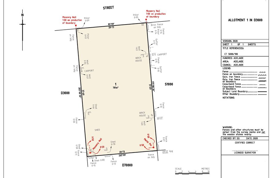
Property Boundary Surveys - This involves a detailed examination, measurement & demarcation of the physical boundaries of a piece of land.
Subdivision & Consolidation Of Land - Subdivision refers to the process of dividing a larger piece of land into smaller pieces or parcels. This is typically done to create new lots or parcels for development, sale, or other purposes.
BMH Land Surveyors facilitates The Subdivision of Agricultural Land Act, (Act 70 of 1970) and SPLUMA by-Laws, (Act 16 of 2013) with respect to the cadastral requirements on your land.
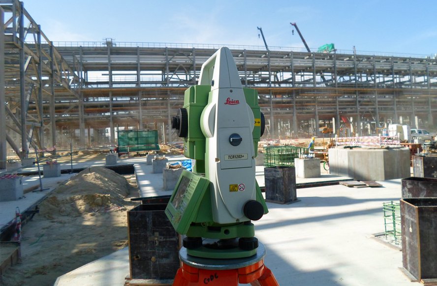
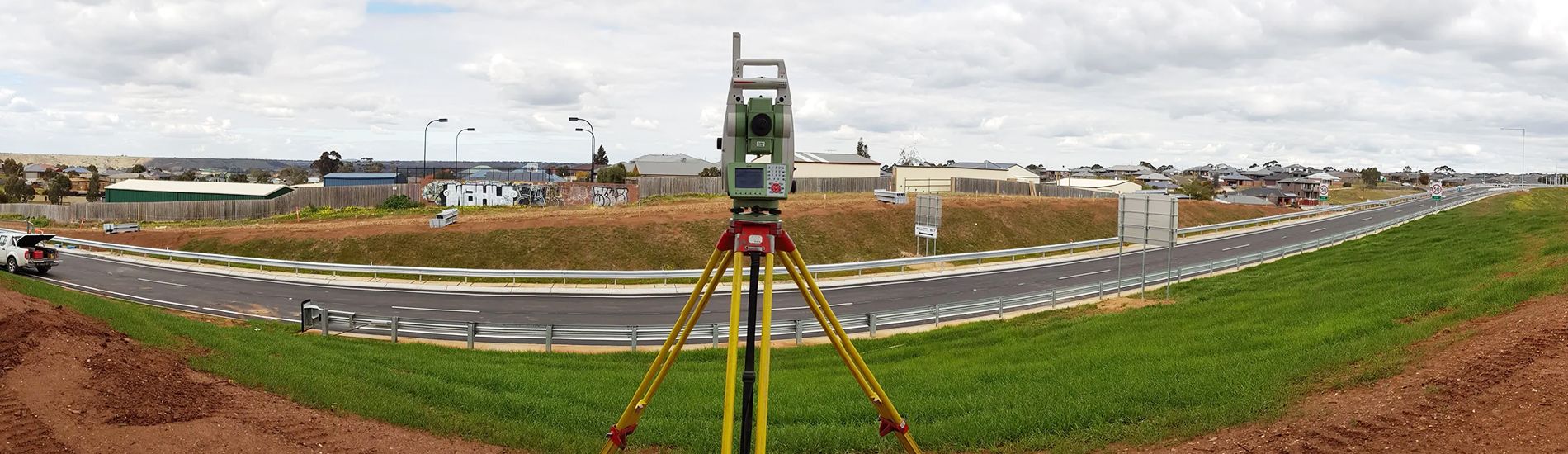
ENGINEERING & CONSTRUCTION SURVEYS
This involves construction surveys whereby Engineer’s or Architects design plans are used to determine the positions on the ground of structures to be built.
This involves setting out in the construction of columns, roads, building corners, pilling and monitoring of these structures as they are constructed.
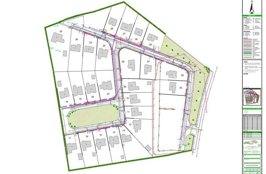
TOPOGRAPHICAL / AS-BUILT SURVEYS
Topographical or as-built surveys are detailed assessments of a specific area of land or a built environment, providing accurate information about the existing conditions and features.
This involves precise measurements and mapping of the terrain, including natural and man-made elements such as buildings, roads, utilities, vegetation, contours, and other physical characteristics.

SECTIONAL TITLE SURVEYS
A sectional title survey is a specialized type of land survey conducted for properties that are subject to sectional title ownership arrangements.
Sectional title ownership is a common form of property ownership in multi-unit residential or commercial developments, where individual units or sections within a building or complex are owned separately, while common areas are owned jointly by all owners.
TOWN PLANNING SERVICES
Land Use Management is the process of establishing or implementing any measure taken to regulate the use or change in the form or function of land, and includes land development. We offer the following land use management applications:
• Land Rezoning
• Subdivision
• Special Consent Applications
• Temporary Departure/ Relaxation Applications
• Removal of Restrictions in Title Applications
• Business Plans
• Land Use Studies
• Land Development Advice
• Township establishment and formalization

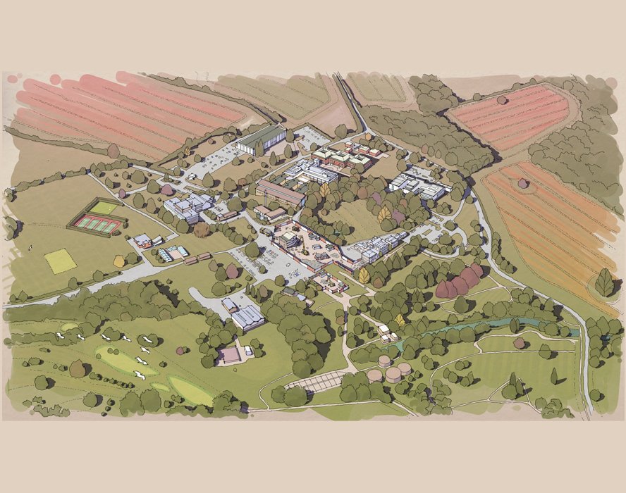
DRONE SURVEYS
An aerial survey involves collecting geographic data or information from the air using aircraft or drones equipped with specialized sensors.
These surveys are used for mapping, environmental monitoring, urban planning, agriculture, forestry, and natural resource management.
Data collected is processed and analysed to derive insights for decision making by various stakeholders.